by Lydia - GIS Spatial Analyst @Slopes
Living in Montana, I'm blessed with seemingly endless snow and tree runs to take turns through. But traveling around, I've come to find that there's a thrill in discovering new places and sliding into new worlds with fresh snow and new sensations rushing under my feet. There's always the excitement (and anxiety!) of navigating a new resort - “Did I take the right turn?"- hoping not to end up on the opposite side of where you're supposed to be, or worse — in someone's backyard.
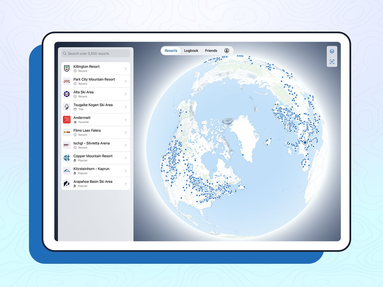
Slopes interactive maps are really cool and handy. They allow you to see your position on the mountain relative to the runs, lifts, and amenities of the resort, and also look for your friends. Whether you're searching for the best tree runs or the easiest route from the summit to where your party is, our maps are the best way to help you orient yourself with your surroundings, in real-time, in 3D.
We have an entire department dedicated to creating and maintaining maps. Yes, we make our own maps, which often raises the question, "Why do you do it? Haven't ski resorts been mapped a thousand times already?" The short answer is… not so short. We create our maps because we realized there wasn’t any reliable (and large enough) collection of high-quality digital resort maps out there — and it's not like we weren't searching. Moreover, this approach allows us to structure and maintain the data in perpetuity and in a way that seamlessly integrates with our app, providing the best possible experience.
Is it time-intensive to map ski resorts? You bet! Is it worth it? We wouldn't do it otherwise. Curious to see how?
The Process
At the most basic level, each symbol on a digital map represents at least one set of geographic coordinates that relate to a specific location on the Earth’s surface. Spatial data like this is most useful when stored using geographic information systems (GIS). GIS is a powerful tool that allows us to store the data we create with a host of non-spatial information, aka attributes, containing essential information for displaying and describing the resort data. Attributes are stored as layers in the software - Walkways, Runs, Lifts, Buildings, are all layers used to create the maps in the app.
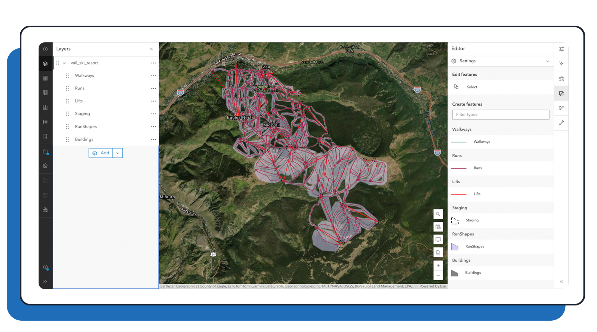
Slopes maps include almost everything you'd find on a resort trail map and enhance the spatial awareness when navigating resorts. It's hard to find your way among the trees with a printed or an overlayed pdf, but that's not the case on Slopes ¯\(ツ)/¯.
Starting the process, it’s important to know where to find the most current and accurate information to reference. This information comes from two primary sources: 1) the official ski resort website and 2) Skiresorts.info, maintained by the National Ski Area Association (NSAA).
Creating Spatial Data
Mapping ski resorts from scratch, we use GIS software to layer our data over high-resolution imagery and other spatial datasets. This imagery, often at 1-meter resolution in many parts of the world, comes from satellite and aerial sources. We use it as a reference to manually draw resort features (yup, that's right, we draw overlays by hand) in their correct geographic locations. The fine resolution of the imagery allows us to clearly map lifts and resort buildings.

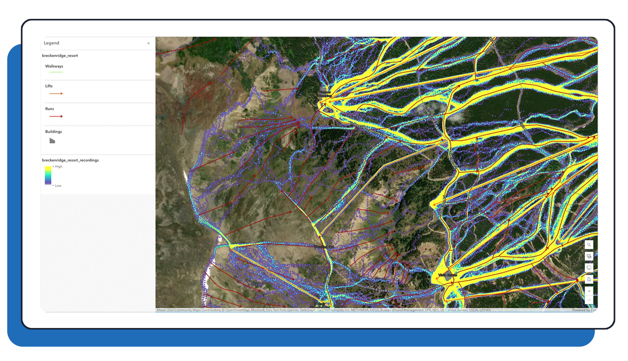
While we can often see where trees have been cleared for ski runs, accurately placing the runs is more challenging. Run paths are often close together, and there's no clear marker to indicate their start and endpoints. Similarly, it's difficult to determine the location of walkways from imagery alone. To accurately map runs and walkways, we need additional information. How do we really know where the runs go? This is where our Slopes data comes into play.
We use fully anonymized data from Slopes recordings to improve the accuracy of our maps. We plot a subset of this data as a heatmap and layer it under the resort. Combined with official trail maps, we are then able to determine where to add run lines, and their orientations. This information removes the guesswork and provides us with good accuracy.
Map QA
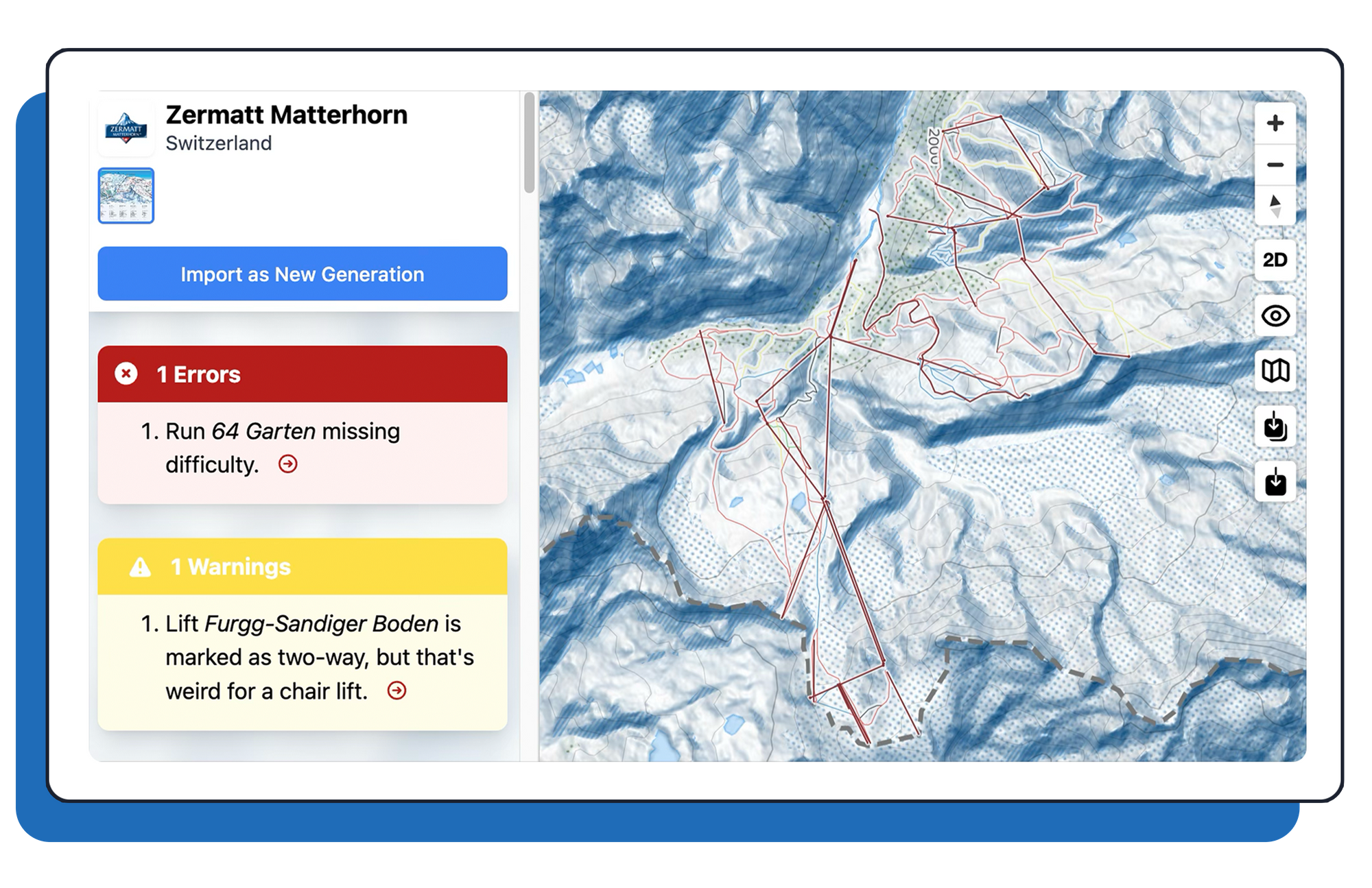
After mapping a resort, we then check to make sure the data is correct. Our first quality assurance step uses a custom-built tool designed for Slopes resort data structure. This tool identifies unusual combinations or missing attributes, flagging errors and warnings. Alerts prompt us to review and correct the data as needed.
Getting a second pair of eyes is essential in catching errors such as discrepancies with official resort maps, misspellings, misplacements, and incorrect attribute inputs. We use Slopes heatmaps in our QA checks to verify that features are correctly positioned.
QA is a constant, ongoing process. Our resort map data is revisited annualy, when ski areas are upgraded, removed, or expanded. At the start of each season, when new maps are released, our data analyst manually compares the current trail map to the one from previous seasons. They will identify features that need updating and pass the information to our GIS analysts for changes.
But that’s not all! We also make updates based on user-submitted corrections. These submissions are invaluable to our QA process, and we can't stress that enough. We have a network of dedicated snow sports enthusiasts who help by submitting corrections through the app (one of them might even be you). When a user reports an issue, our mapping team starts to investigate the matter further.
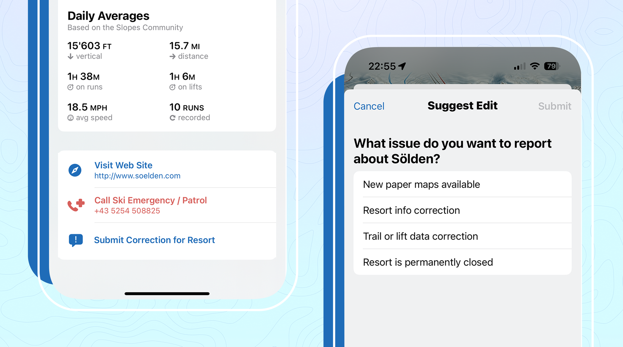
Once the mapping process is complete, Curtis does his server magic, and the resort data becomes available for users to interact with and enjoy.
It takes a ski village to get it right, so we highly encourage slopes enthusiasts to write in about the maps and submit corrections. You help us make the app great, and we appreciate the feedback.

