
by Curtis - aka The Slopes Guy
Weather, the guide tab, the map redesign … you’d be forgiven for thinking we were done announcing stuff this season. Last one, I promise. 😅
Last spring I fell into a bit of a dopamine-chase, building tools to help me read the mountain and plan my days better. It started with the unexpected slush-filled days in March(!!) at Breck, wanting to easily plan my day around where the snow would soften up first after a deep overnight freeze.
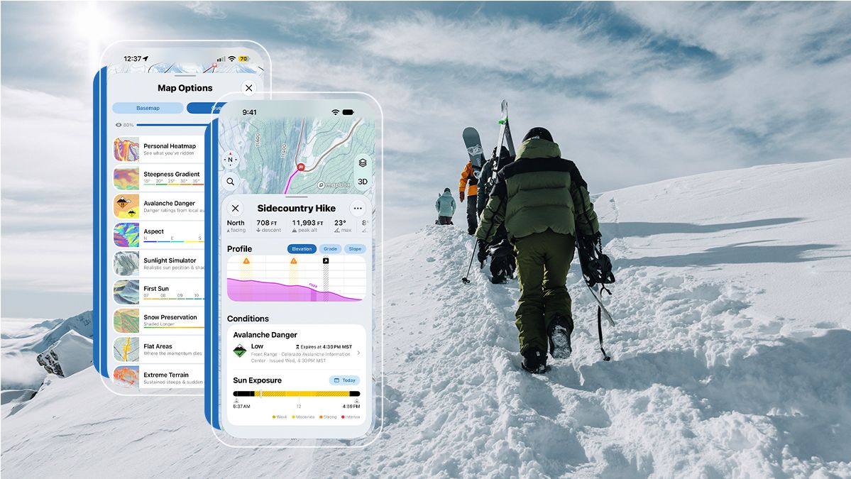
Somewhere along the way it stopped being a little side project and turned into what we're releasing next week: Slopes Explore. It’s a new tier in Slopes: everything you get with Plus, plus 11 new map overlays, personal heatmaps, a route planner built that doesn't suck on mobile, and custom offline regions for the backcountry.
Tools for hunting the best lines, both inside the ropes and out.
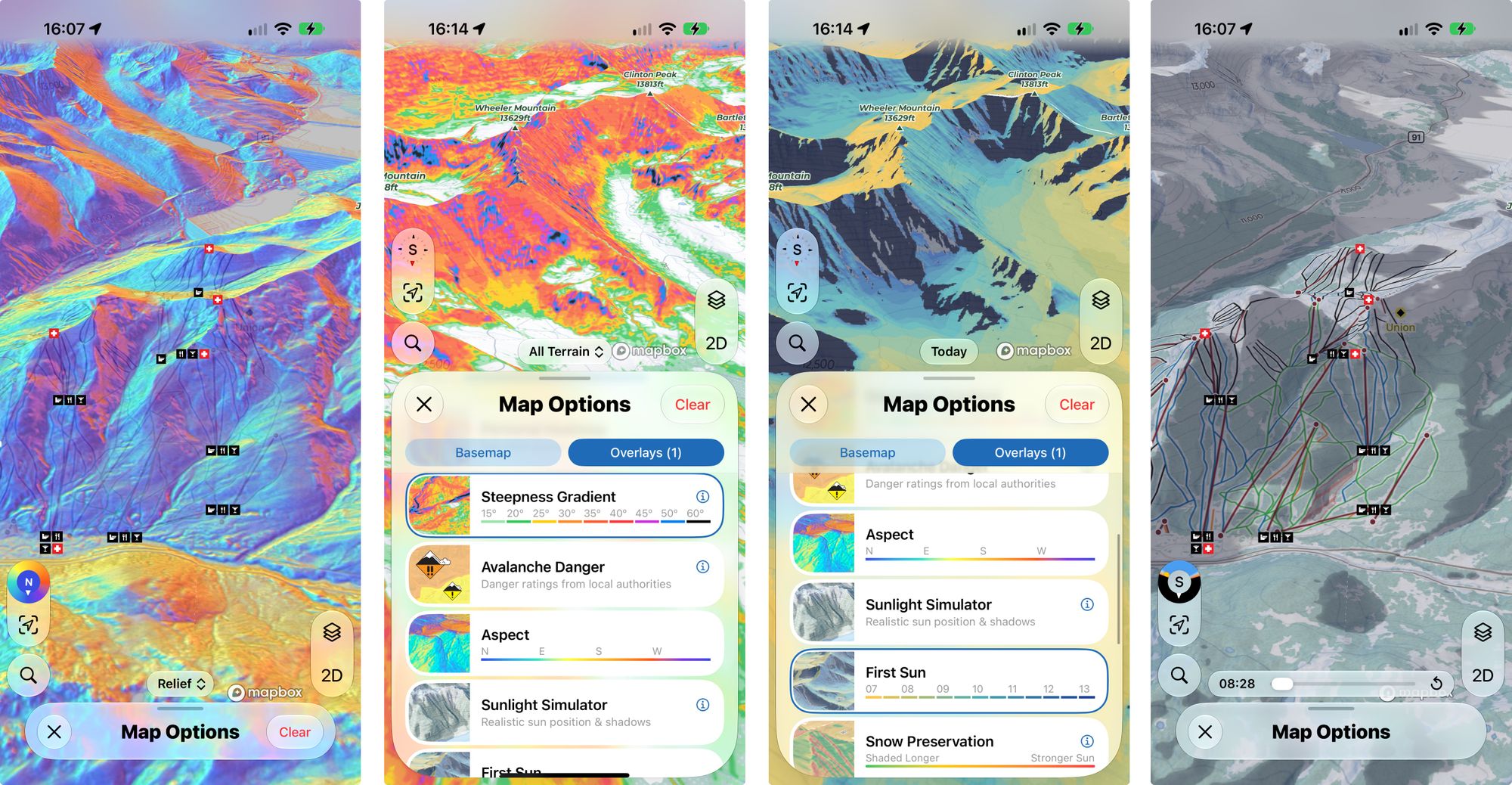
11 Map Overlays
Some are familiar tools, like aspect and slope angle shading, but some are unique to Slopes with the goal of visualizing data you'd have to infer yourself.
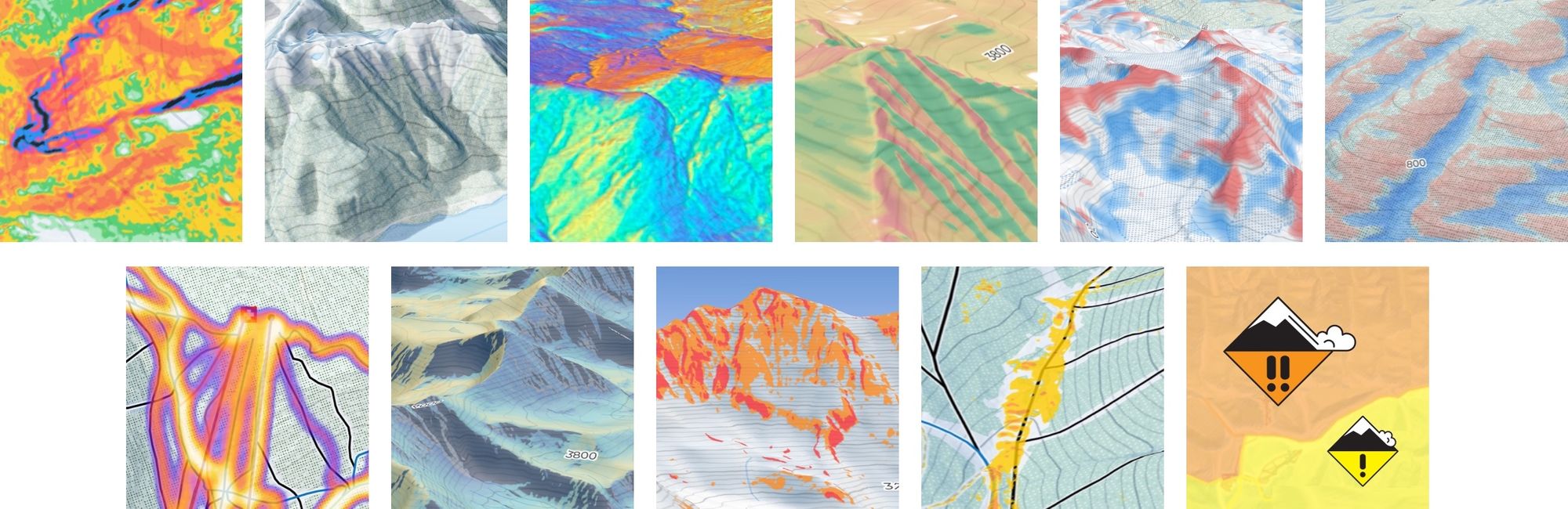
One unique to Slopes is the Snow Preservation layer (top row, 4th thumbnail). This overlay lets you pick any day of the year and it will highlight where you're most likely to find snow not strongly impacted by the sun. It works by taking the sun's position as it moves through the sky and calculating the solar energy any given face will accumulate.
(Don't worry my fellow science nerds, that's an dramatic over simplification and there's a lot more behind how it acutally works.)
Another unique overlay is the Wind Loading Simulator (top row 6th thumbnail). It builds on top of the more basic Terrain Curvature overlay (5th thumbnail, showing troughs vs ridges) and will highlight areas that are likely to be wind-scoured vs those that are likely to be wind-loaded. We default the simulation to the most-likely wind direction for a resort, but you can play around and adjust it using an on-screen compass. This overlay does assume a constant wind speed and snowfall, so it's not an exact representation or based on the overnight snowfall, but it's a great tool for learning the mountain and where to hunt for powder stashes after a storm.
I already mentioned aspect shading and slope angle, but there's also "first sun" for seeing when the sun hits a given area on any day of the year, and a full sunlight / shadow simulator with accurate lighting physics that can take a date and time.
And last but not least, and certainly by popular demand, there's an overlay showing your personal heatmap of everywhere you've ridden. If you zoom in you'll be able to see all your tracks, and you can even turn off lift rides if you're trying to make sure you checked off all the skiable lift-lines.
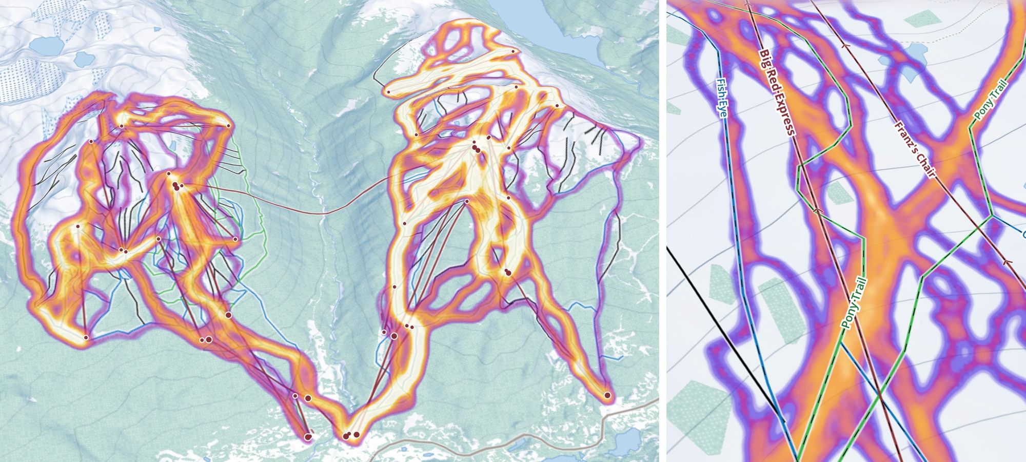
Let me tell you, this was a fun one to build. I put it off for a long time because it is a lot of data to load for some people, so much so that Mapbox's built in heatmap layer just can't handle it. I had to roll my Metal shader. But doing so let me support people like my one friend from Stowe who has over 750 days recorded there.
Route Planning
In the last post, I talked a lot about how a personal library of routes / places / areas was coming to Slopes. While you can convert existing recordings in Slopes to routes, and import from any other app, as part of Slopes Explore we have a powerful route creation tool designed for mobile.
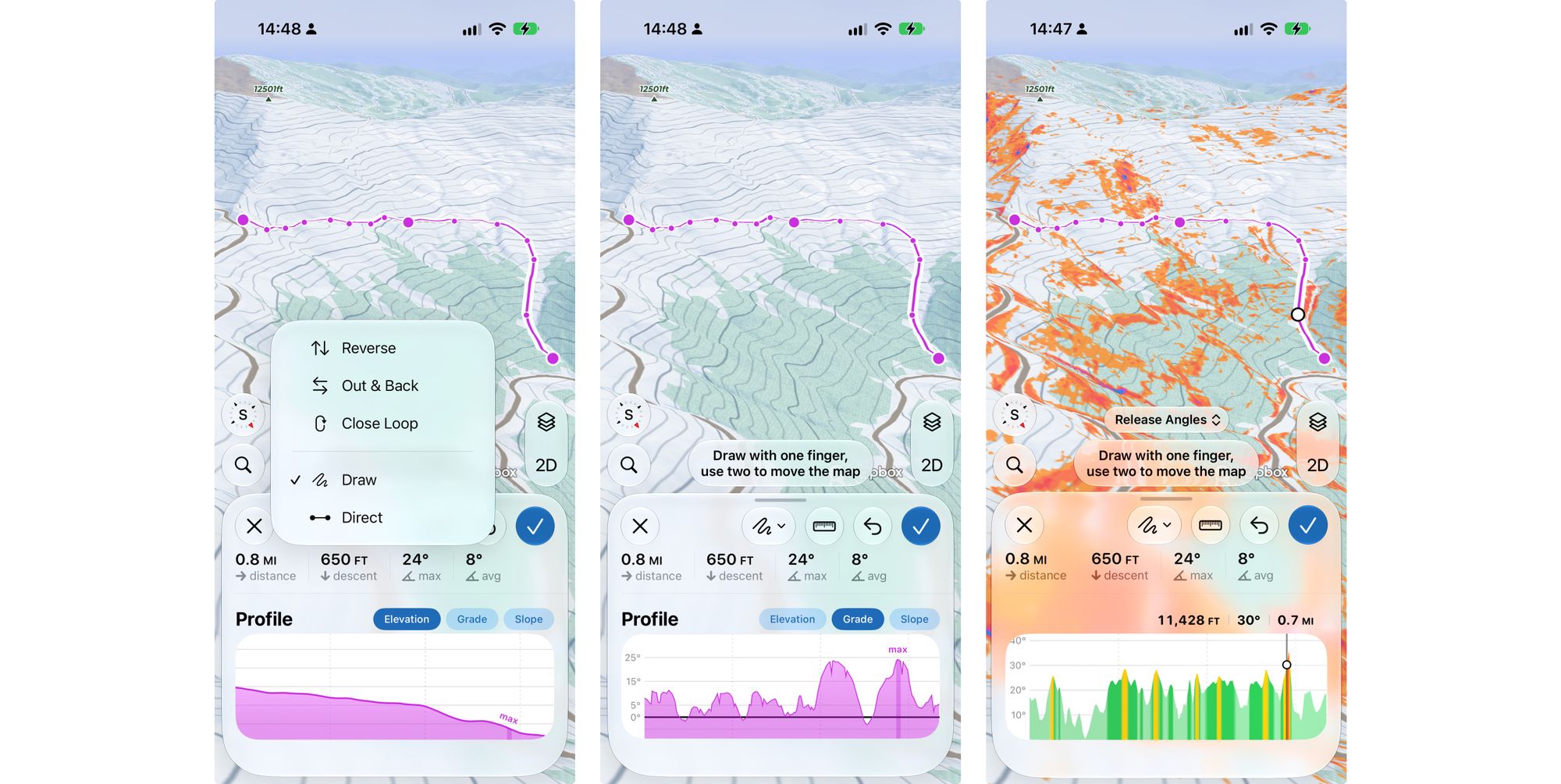
It has everything you'd expect: the ability to tap-to-add points vs free-draw, the ability to move points you placed, undo/redo support, the ability to do an out-and-back or just close the loop, and the ability to measure any two points along your path or on the map.
Our route planner surfaces the critical information you need while planning. Along with a standard elevation chart, you can see the grade of the path you're taking (to judge level of effort and capability) vs the slope angle of the terrain itself (the slope your path is crossing). This will help you judge if you need to add in some switchbacks to keep the grade within your capability, or if you need to replan a route because you're crossing terrain that puts you at a higher risk.
Speaking of planning, Slopes now also includes Avalance Forecasts from almost all the major reporting centers world-wide. We'll show the most recent report summary, both on the map as an overlay and as a banner on any routes after you plan them.
Custom Offline Regions
We shipped offline maps for ski resorts a few years ago for Slopes Plus subscribers, and with Explore we're adding the ability to define your own custom regions. When you define a region, you can see a preview of the data usage and pick if you want to include satellite maps or save space without them.
Because our offline maps now include the new high resolution digital elevation model I spoke about in the last post, most of the overlays will work fully offline too (although they won't go down to the super high 1m resolution in offline mode).
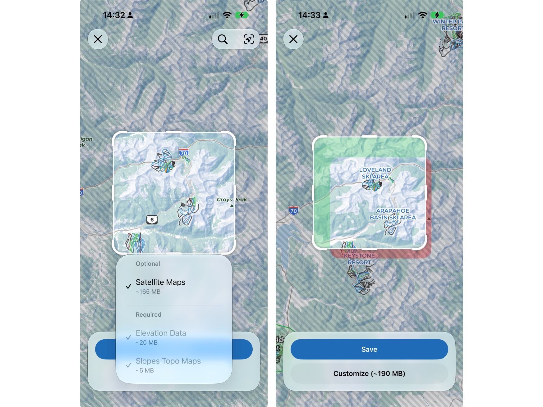
And of course, just because I'm a software engineer, if you go in and edit an offline region you'll get diff tool showing what you're adding to the region and what you're taking away.
As part of building these new offline regions, I spent a lot of time testing and ensuring our offline map system was a bullet proof as possible. Existing Plus users will get the benefit of all the work that went into improving the offline map system.
Slopes Explore is launching on November 10th for iOS at $79.99/yr. If you're already on Slopes Plus, you'll be able to upgrade when it launches for only $59.99 for the first year. There's also a family plan, and Explore will be coming to Android later this season.
