
by Curtis - aka The Slopes Guy
Slopes has always been built around the resort: track your day and your vert, replay your runs, and see which lift your friend accidentally ended up at. But as crowds and resort prices increase, more of us are heading outside the resort boundaries.
Over the summer we released updates for iOS and Android to better support skinning and cat skiing. This week we're taking a much bigger step to make Slopes your home when you head out the gate, too.
Your Private Library
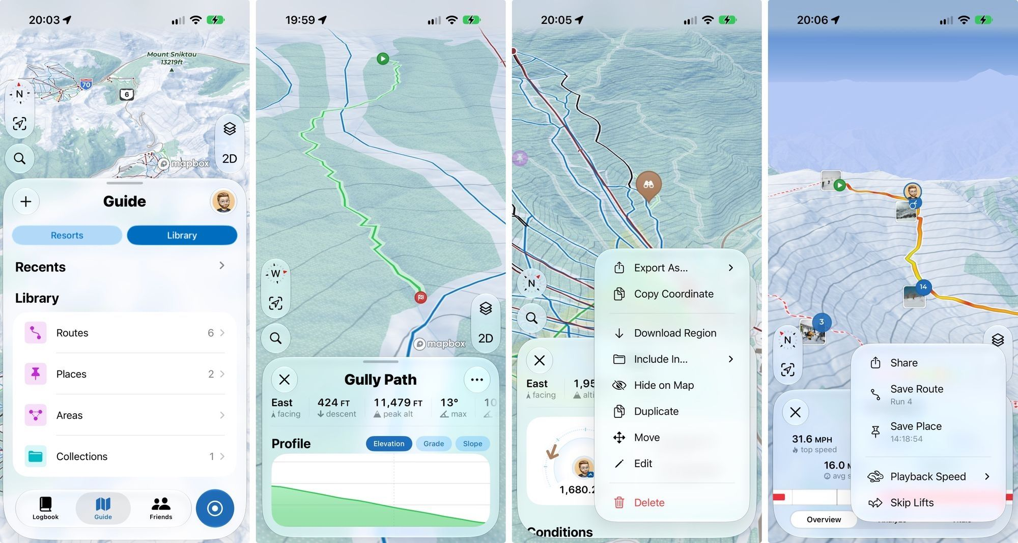
Something we've heard a lot from users is the desire to build their own library of data in Slopes, both in-bounds and out. There's so much thats never on the resort trail maps: that line through the trees with the sick gully, that hut you found tucked away, ... or a pin where you think you dropped your Insta360.
This season we're turning the Resorts tab into something new: the Guide tab. It's split out by resort maps & data and by your custom data.
Your library consists of routes, places, and areas. Getting data into your library is easy - you can import from all the common mapping apps, or you can convert any lift or run you recorded on Slopes into a route or place via the timeline screen.
Once it's in your library, Slopes has the powerful organization tools you'd expect. Give items custom icons and colors on the map, add any notes you need to remember the details, and organize them into one or more collections (folders). Hide and show items or entire collections on the map to help de-clutter as your library gets big.
This is an awesome feature, and we want everyone to have it. Some features in the screenshots above like the elevation profiles on routes require Slopes Plus, but the core import/export/organize is free for an unlimited number of items.
The Guide tab is coming out on Nov 10 for iPhone. Once Android launches Guide (already in the works!), our next step is making collections sharable between your friends within Slopes. We're not here to ruin your secret stashes though with some public "social discovery" or "places near me" bull, don't worry. This collection sharing will be private and only with the friends you choose to share with.
(And we have some more cool ideas to build on top of all that...)
Redesigning Our Maps
We know a library of your own data like this is very powerful outside of the resorts. But lets be honest ... Slopes's maps aren't great outside of resorts.
I take a lot of pride in the work our mapping team does to make the data in our maps great. The team hand-maps over 600 resorts world-wide to ensure the freshest and best data possible. But while our data is great, the maps themselves have been held back by my aging map designs. See, our maps were designed back when the only goal was only to showcase the runs you took, not help you plan out your tours.
I'd like to highlight three big things that are coming together to bring us our new topo map style.
01 - Design and Data
I spent a ton of time this summer researching cartography and map design so I could ensure everything is readable and easy to parse at a glance. I had a lot to learn, because all of a sudden we needed to show a lot more data.
Oh, and ya know, fix the small things like not having contour lines obliterated by our tree layer 😅.
In the new style, roads and buildings are no longer trying to be invisible with their white fills and weird dot-patterns. Hiking trails and service roads are added to the map, since those are important for touring. Peak names are now on the map (with elevations localized!), and parking lots are much easier to find so you know where the trailheads are.
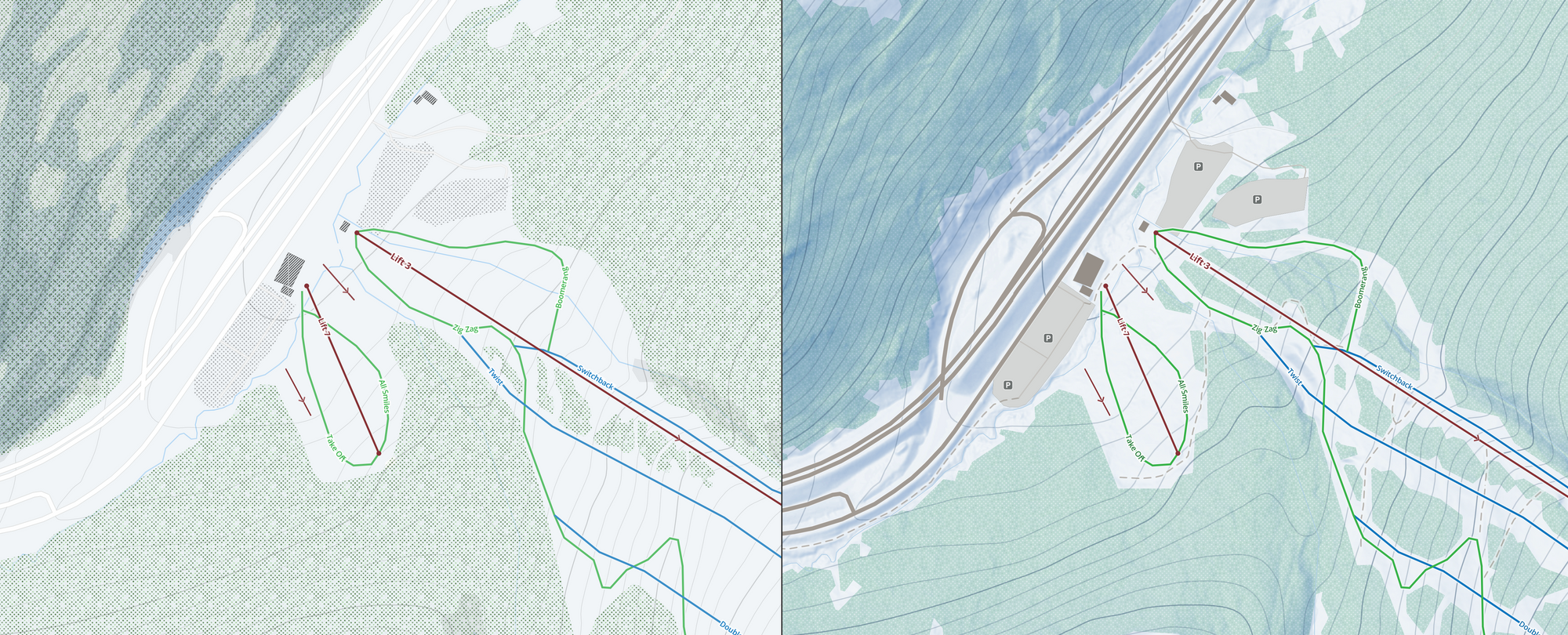
Shout out to our beta testers for providing a ton of useful feedback as I iterated the new map design. It wouldn't have improved this much without you!
02 - HD Terrain
If you loved FATMAP (RIP 😢), you're going to love this update.
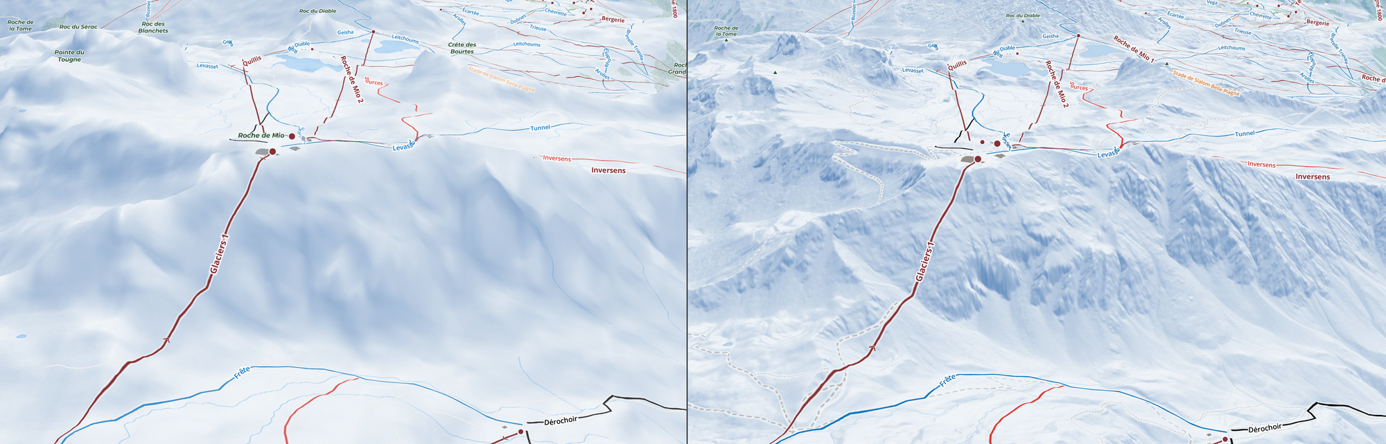
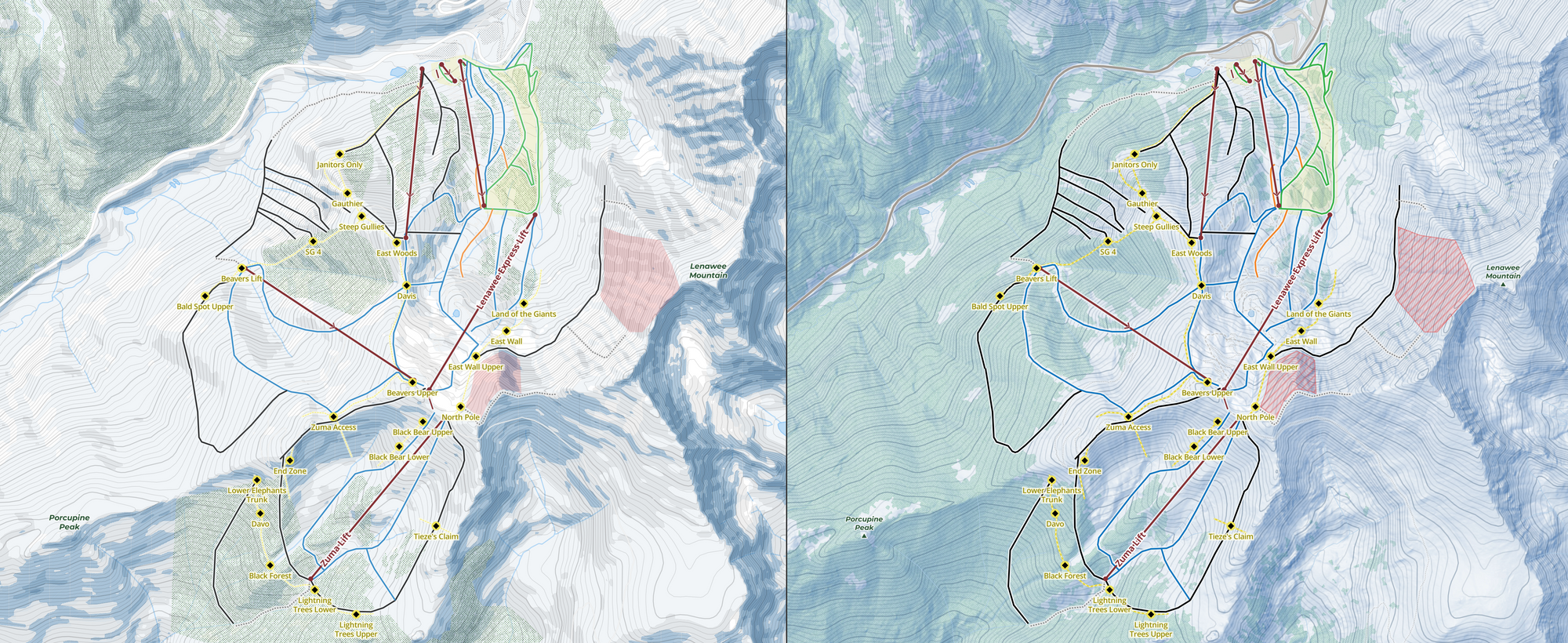
When talking about digital elevation models (DEMs) (the things that let us programmers query "what's the elevation at this lat/lon?") you talk about its resolution, which is how many meters a single pixel represents. A 30m DEM (the consumer-grade standard for a long time) means the surface of the region is broken up into 30m x 30m (33 yards x 33 yards) chunks that then get represented by a single elevation for that entire square.
At ski resorts where a lot of complex terrain exists, 30m x 30m chunks having a single elevation value really limits how much detail we can show. You can see that above on with the image on the left with how ... blob-like ... the mountains seem.
But if you get a higher resolution DEM, the small details that become visible are crazy. For example, you can see the hiking trails and small service roads from the DEM alone at Niseko.
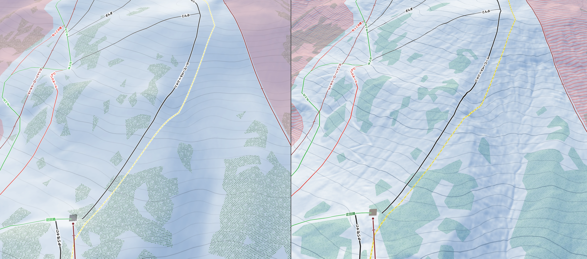
What's on the right in both of these images is Slopes's hillshading and 3D models powered by our new high resolution DEM. The DEM has 10-meter resolution at most ski resorts world-wide, and improves to 5 or even 1-meter (🤯) resolution in lots of Europe and parts of the US.
Oh, and as part of the map redesign, this new high resolution hillshade styling is no longer limited to maps in 3D mode; it's the default in 2D maps in Slopes going forward.
03 - HD Trees
Most consumer apps rely on OpenStreetMap and their tree coverage data, which is crowdsourced and its accuracy and coverage varies a lot from place to place. A few years ago Apple, and now Google, upgraded their maps using machine learning trained to read satellite imagery in order to rebuild a fresh layer that's more detailed and has more consistent coverage.
A almost two years ago I got tired of seeing such spotty tree data in Slopes and declared it was time to tackle an ambitious project like this ourselves. After all, trees are such a defining characteristic of ski maps, I really wanted them to be as "right" as possible.
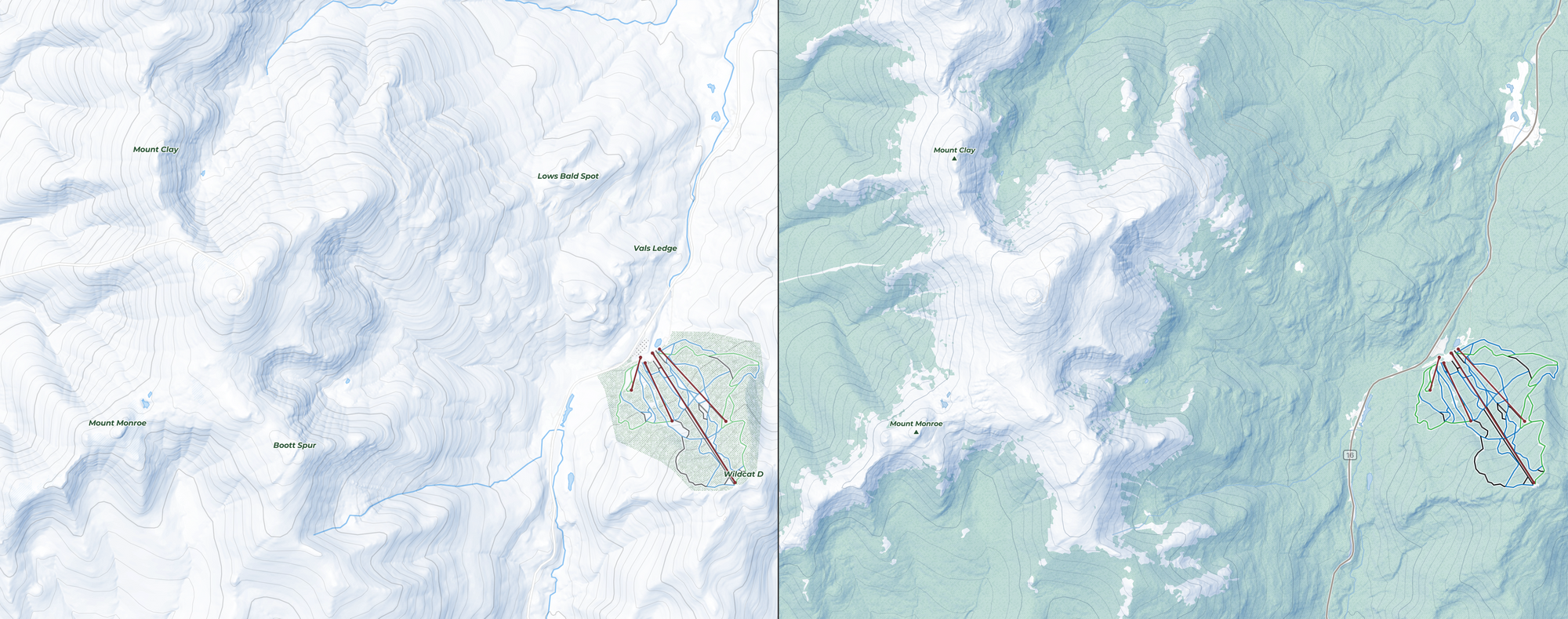
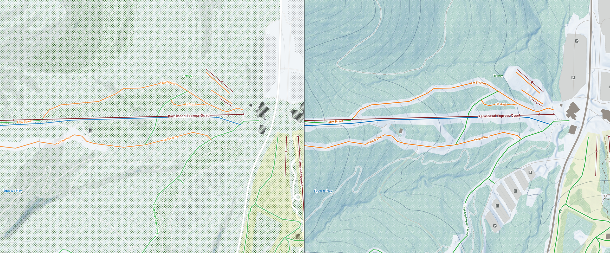
The process for this was a bit crazy, taking a year and a half and a mini super computer, but it was so worth it. The end result of what our mapping team pulled off is amazing, both in-bounds and out of bounds. And this is just version 1 of our HD trees process; we're going to keep making improvements and updating our data as time goes on.
Combined with our in-house resort trail data, this new topo map style, HD terrain, and HD trees push Slopes even further ahead as the best map for skiing.
You can grab these new maps as a free upgrade for Slopes Plus subscribers on Nov 10 for iOS, with Android coming later this season.
